
Frankreich – Buch gebraucht, antiquarisch & neu kaufen
Sie sammeln Bücher?
Wir haben für Ihre Sammlung eine Auswahl besonderer Bücher aus dem BereichFrankreichzusammengestellt.
21 Treffer in
Bücher
gebraucht
Neuware

Südfrankreich
Günter Liehr
Rowohlt Taschenbuch
, 1993, TaschenbuchISBN: 3499175827
Zustand: leichte Gebrauchsspuren
mehr Info >>
wird gespeichert …

Corse Sud de Vizzavona à la Montagne de Cagna: 215 Itinéraires de Randonnées pédestres. 1 . 50 000
I.G.N.
Éditions Didier et Richard
, 1990Zustand: leichte Gebrauchsspuren
mehr Info >>
wird gespeichert …

Le Donon; Lac de Pierre-Percée 3616 OT, Top25
IGN, Club Vosgien-Strasbourg
1999
Zustand: leichte Gebrauchsspuren
mehr Info >>
wird gespeichert …

Plan Guide de Marseille et sa banlieu. Noevelle Edition
Bleu et Or
Service Ventes
, SoftcoverZustand: deutliche Gebrauchsspuren
mehr Info >>
wird gespeichert …


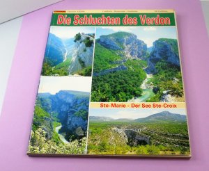
Die Schluchten des Verdon: Ste Marie, Der -See Ste-Croix: Die großen Landschaften des Verdon, "der Gott der grünen Wasser"
Marc Guitteny
1993, Heft/Zeitschrift
Zustand: deutliche Gebrauchsspuren
mehr Info >>
wird gespeichert …

Compiègne et environs: Plan de Ville 1 : 11000
Blay-Foldex - Kümmerly + Frey
Blay Foldex
, o. J., Brief/Blatt/LandkarteZustand: leichte Gebrauchsspuren
mehr Info >>
wird gespeichert …

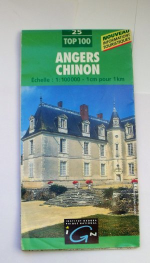
Angers. Chinon, Èchelle : 1 : 100 000; La Carte Touristique Locale ( 25, Top 100; Nouveau: Informations Touristiques)
Institut Geographique National (= IGN)
2001, Brief/Blatt/Landkarte
Zustand: leichte Gebrauchsspuren
mehr Info >>
wird gespeichert …


LYON et son agglomération: index des rues, sens unique, transport; Straßenkarte Lyon und Großraum Lyon mit Straßenerzeichnis, Einbahnstraßen (-Kennzeichnung), Nahverkehr
Plans-Guides Blay
Plans-Guides Blay
, 1988, kartoniertZustand: leichte Gebrauchsspuren
mehr Info >>
wird gespeichert …

Rouen, Abbeville, 1 : 100 000: Carte Topographique Top 100, Carte de Promenade 03/Wander-/Radwander-Karte
Institut Geographique National
IGN
, 2002, Brief/BlattZustand: leichte Gebrauchsspuren
mehr Info >>
wird gespeichert …


parc naturel régional de camargue, 1 : 50 000, 1 cm pour 500m(303)
institut géographique national
1984, Brief/Blatt/Landkarte
Zustand: leichte Gebrauchsspuren
mehr Info >>
wird gespeichert …

Carte de Promenade 70: Pau, Bagnéres-de-Luchon, 1 : 100 000; (= Carte Topographique Top 100)
Institut Geographique National (= IGN)
IGN
, 2004Zustand: leichte Gebrauchsspuren
mehr Info >>
wird gespeichert …

Carte des Aires de Services 2007: Wohnmobil Stellplätze
Camping-Car Magazine
2006
Zustand: deutliche Gebrauchsspuren
mehr Info >>
wird gespeichert …

Massif Du Ventoux: Dentelles de Montmirail Monts de Vaucluse. Provence, 1 : 50 000 (27): 295 Itinéraires de Randonnées pédestres et équestres
Éditions Didier Richard ( Cartes IGN)
1989
Zustand: leichte Gebrauchsspuren
mehr Info >>
wird gespeichert …

Pyrenees-Orientales: Le Pays Catalan à la carte Coté soleil ! - Tourismus-Karte Franzöische Pyrenäen
Comité Départemental du Tourisme des Pyrénées-Orientales
o.J.
Zustand: leichte Gebrauchsspuren
mehr Info >>
wird gespeichert …

Süd-Frankreich per Rad
Stefan Pfeiffer
Kettler, W
, 1990, TaschenbuchISBN: 3921939356
Zustand: leichte Gebrauchsspuren
mehr Info >>
wird gespeichert …

Thuir, Ille-sur-Tet, 1 . 25 000 (= La Carte de Randonnée, 2448 OT/TOP25) Wander-Radwander-Karte
Institut Geographique National (= IGN)
IGN
, 1999Zustand: leichte Gebrauchsspuren
mehr Info >>
wird gespeichert …

Reisebuch Loiretal-Atlantique: Von Maine/Anjou zum Ozean, von der Südbretagne zur Vendée
Kleppinger, Monika; Béziat, Annette
Meyer & Meyer
, 1997, TaschenbuchISBN: 3891244266
Zustand: leichte Gebrauchsspuren
mehr Info >>
wird gespeichert …

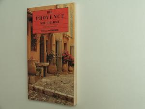
Die Provence mit Charme
Nathalies Mouries
Rivages/GeoCenter
, 1995, BroschurISBN: 2869308698
Zustand: leichte Gebrauchsspuren
mehr Info >>
wird gespeichert …
mehr Info >>
wird gespeichert …

guide des autoroutes ASF (= Autoroutes du Sud de la France) . 1986: A7, Autoroute du soleil; A8, la provencal; A9, la longuedocienne, la catalane; A10, l'aquitaine; A 61, autoroute des deux mers; A62, autoroutes des deux mers; A64, la pyrénéenne; A72 Clermont-Ferrand, St. Étienne
Direction de la communication
1986, Brief/Blatt/Landkarte
Zustand: leichte Gebrauchsspuren
mehr Info >>
wird gespeichert …

